repoman
Contributor
i am not just talking about satellites, planes or files of old pictures run through a computer looking to match the terrain - though that would help.
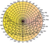
What i am talking about is a sundial effect to see how the shadows move versus time. By now they are getting a good sample size of footage that each has a day associated with it. Can a good guess of latitude by gotten out of the data to limit the terrain search?
What i am talking about is a sundial effect to see how the shadows move versus time. By now they are getting a good sample size of footage that each has a day associated with it. Can a good guess of latitude by gotten out of the data to limit the terrain search?


